

Our Services

Spray or spread by drone
Fungicides
Herbicides
Foliar fertilisers
Seed
Snail Pellets

Map your fields using multispectral imaging. See more than the human eye sees.
Visualise vegetation indices such as NDVI and NDRE
New App!

Imaging
Calibrated block area
Slope/elevation analysis
Accurate block maps
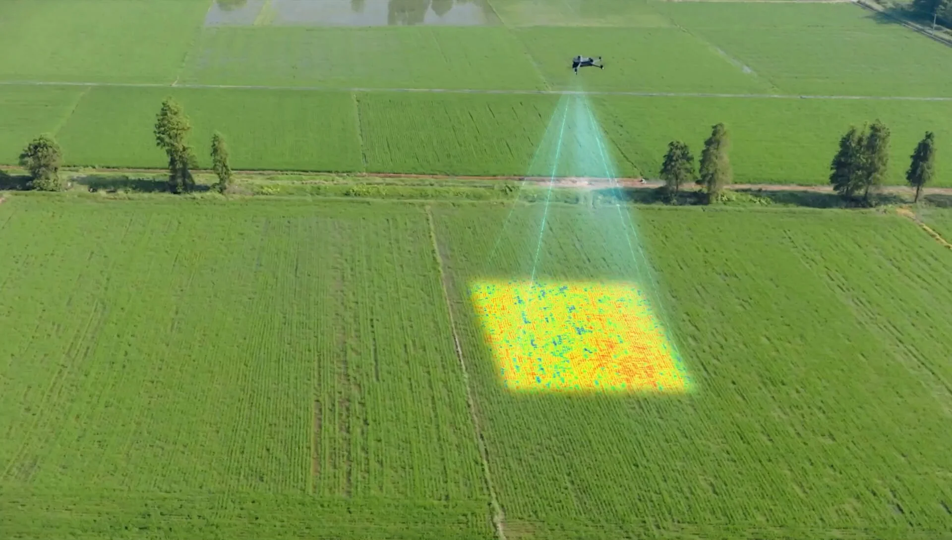
Converting NDVI maps into prescription maps to target spray areas that are needed and leave the areas which don’t need it.
Saving on chemical usage
Contact Us
Interested in working together? Fill out some info and we will be in touch shortly. We can’t wait to hear from you!